File:Syria intelligence report map.jpg
Jump to navigation
Jump to search
Syria_intelligence_report_map.jpg (800 × 526 pixels, file size: 118 KB, MIME type: image/jpeg)
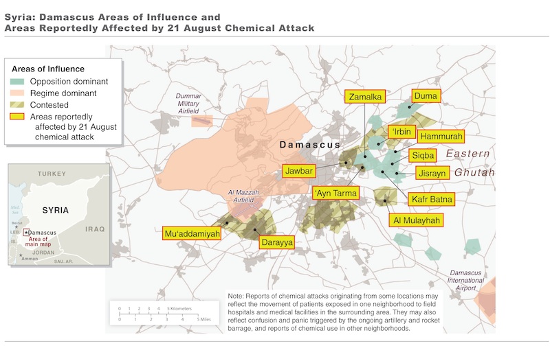
An unclassified U.S. intelligence assessment released Friday was accompanied by a map that shows areas reportedly affected by a chemical weapons attack in Damascus, Syria on Aug. 21. More than 1,400 people were killed the attack, including 426 children, according to the assessment.
- Source
- jpg file
File history
Click on a date/time to view the file as it appeared at that time.
| Date/Time | Thumbnail | Dimensions | User | Comment | |
|---|---|---|---|---|---|
| current | 21:19, 30 August 2013 |  | 800 × 526 (118 KB) | Petri Krohn (talk | contribs) | An unclassified U.S. intelligence assessment released Friday was accompanied by a map that shows areas reportedly affected by a chemical weapons attack in Damascus, Syria on Aug. 21. More than 1,400 people were killed the attack, including 426 children... |
You cannot overwrite this file.
File usage
There are no pages that use this file.
