File:South China Sea radiation detected.jpg
Jump to navigation
Jump to search


Size of this preview: 800 × 368 pixels. Other resolutions: 320 × 147 pixels | 1,269 × 584 pixels.
Original file (1,269 × 584 pixels, file size: 56 KB, MIME type: image/jpeg)
Summary
- Source
- IndoPacific News @IndoPac_Info on Twitter, November 21, 2019 at 6:48 UTC
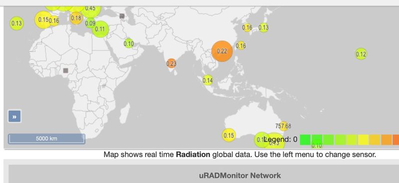
- This is the picture from the radiation levels map from Uradmonitor. Can see the big spike in orange reading 0.22. But again, a little off from what the article mentioned, but not much. For everything else, no independent confirmation yet. Seismographic data shows nothing so far.
- Chinese nuclear submarine tore into the sea – RADIATION DETECTED!!! - Free News, November 23, 2019
- Radiation is now being detected at shore monitoring points around the South China Sea!
- According to this official map from the uRADMonitor Global Environmental Monitoring Network, “significant” radiation readings are now registering on their radiation monitors, shown on the map below:
File history
Click on a date/time to view the file as it appeared at that time.
| Date/Time | Thumbnail | Dimensions | User | Comment | |
|---|---|---|---|---|---|
| current | 20:50, 23 November 2019 |  | 1,269 × 584 (56 KB) | Petri Krohn (talk | contribs) | Source https://twitter.com/FdG_reborn/status/1197418072757456896 |
| 20:02, 23 November 2019 | 1,190 × 414 (93 KB) | Petri Krohn (talk | contribs) | ;Source * [https://freenews.live/chinese-nuclear-submarine-tore-into-the-sea/ Chinese nuclear submarine tore into the sea – RADIATION DETECTED!!!] - ''Free News'', November 23, 2019 *:''Radiation is now being detected at shore monitoring points aroun... |
You cannot overwrite this file.
File usage
The following page uses this file: