File:MH17 last point from TAMAK.png
Jump to navigation
Jump to search


Size of this preview: 556 × 600 pixels. Other resolutions: 222 × 240 pixels | 622 × 671 pixels.
Original file (622 × 671 pixels, file size: 503 KB, MIME type: image/png)
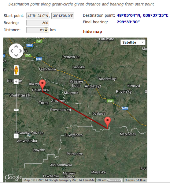
Last normal routepoint of flight MH17 as reported by Russian civilian ATC:
- 51 km in direction 300 degrees from waypoint TAMAK at the Russian–Ukrainian border.
- TAMAK 47°51'24.0"N 39°13'06.0"E
- MH17: 48°05′04″N, 038°37′25″E
Calculator:
File history
Click on a date/time to view the file as it appeared at that time.
| Date/Time | Thumbnail | Dimensions | User | Comment | |
|---|---|---|---|---|---|
| current | 01:45, 8 August 2014 |  | 622 × 671 (503 KB) | Petri Krohn (talk | contribs) | Last normal routepoint of flight MH17 as reported by Russian civilian ATC: :51 km in direction 300 degrees from waypoint TAMAK at the Russian–Ukrainian border. * TAMAK [https://tools.wmflabs.org/geohack/geohack.php?pagename=TAMAK¶ms=47_51_24_N_3... |
You cannot overwrite this file.
File usage
The following page uses this file: