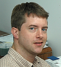
File:Lars Bromley profile.jpg
Jump to navigation
Jump to search
Lars_Bromley_profile.jpg (200 × 220 pixels, file size: 43 KB, MIME type: image/jpeg)
- Source
- American Association for the Advancement of Science
- Alternate version: gisfortheun
Sources
- Lars Bromley - Geospatial Analyst, UNITAR/UNOSAT
- Lars Bromley is an analyst with the UN Institute for Training and Research Operational Satellite Applications Programme (UNITAR/UNOSAT). He was previously project director with the Science and Human Rights Program at the American Association for the Advancement of Science. He has conducted extensive work to apply remote sensing, satellite imagery, and related tools to large-scale atrocities in Darfur, Burma, Ethiopia, and elsewhere, in partnership with Amnesty International, Human Rights Watch, and numerous other organizations. He has published in the International Journal of Remote Sensing, the Georgetown Journal of International Affairs, and other publications and has presented at a wide variety of academic and private-sector venues. He holds an MA in geography from the University of Maryland.
- Lars Bromley - Principal Analyst and Research Advisor - Human Rights and Security - LinkedIn
- I develop and manage humanitarian analyses, human security monitoring, and human rights investigations at the UN Institute for Training and Research (UNITAR) Operational Satellite Applications Programme (UNOSAT). I started in this capacity in July of 2010, and previously I was a Project Director with the Science and Human Rights Program at the American Association for the Advancement of Science. At AAAS I led the project on geospatial technologies and human rights, funded by the MacArthur and Oak Foundations as well as the Open Society Institute. I have extensive experience developing and managing projects that apply remote sensing, satellite imagery, GIS, and related tools to large scale human rights violations and threats to human security. I have testified at the International Criminal Court as an expert witness on satellite imagery regarding the 2007-2008 post-election violence in Kenya and have advised a wide range of UN entities and NGO's on geospatial applications and capacity development.
- Eye in the Sky: Monitoring Human Rights Abuses Using Geospatial Technology
- Citation: Lars Bromley. Eye in the Sky: Monitoring Human Rights Abuses Using Geospatial Technology. Georgetown Journal of International Affairs. Issue 10.1 Winter/Spring 2009.
- Human rights and humanitarian relief organizations have started to use geospatial technologies with the long-term potential for supporting human rights advocacy around the world.
UN testimony
- Aleppo aid convoy hit by air strike: U.N. expert - Stephanie Nebehay, REUTERS, October 5, 2016
- Analysis of satellite imagery of a deadly attack on an aid convoy in Syria last month showed that it was an air strike, a U.N. expert said on Wednesday in remarks that were later toned down to say it was not a conclusive finding.
- Some 20 people were killed in the attack on the U.N. and Syrian Arab Red Crescent convoy at Urem Al-Kubra near the northern city of Aleppo that also destroyed 18 of 31 trucks, a warehouse and clinic.
- The United States blamed two Russian warplanes which it said were in the skies above the area at the time of the incident. Moscow denies this and says the convoy caught fire.
- "We had an image of that and could clearly see the damage there. With our analysis we determined it was an air strike and I think multiple other sources have said that as well," Lars Bromley, research adviser at UNOSAT, told a news briefing.
- "For air strikes, what you are usually looking out for is the size of the crater that is visible and the type of crater," he said. A giant crater was caused "almost certainly (by) air dropped munitions" as opposed to artillery or mortars, he said.
- Syria conflict: Aid convoy attack was air strike, UN expert says - BBC News, October 5, 2016
- Lars Bromley, research adviser at the UN Operational Satellite Applications Programme (Unosat), told a news briefing in Geneva: "With our analysis we determined it was an air strike and I think multiple other sources have said that as well." "For air strikes, what you are usually looking at is the size of the crater that is visible, and the type of crater," he added. "Basically air-dropped munitions are often much larger than anything you would fire from the ground."
- UN releases satellite images of damage in Syria’s Aleppo - Jamey Keaten, The Associated Press, October 5, 2016
- (Article updated, mirrors of original: New York Post, The Times Record)
- In Geneva, an official with the U.N.’s satellite imagery program said the new pictures from the rebel-held areas in the eastern half of the city show much destruction, presumably caused by airstrikes. U.N. and advocacy groups say hundreds of civilians, including at least 100 children, have died in the recent violence.
- “Since the cease-fire has broken down, you certainly see an awful lot of new damage,” said Lars Bromley, a research adviser at UNOSAT.
- The images, from DigitalGlobe and obtained by the U.N. agency through a licensing arrangement with the U.S. State Department, show mostly “formerly blasted and blown-up areas” during Syria’s 5-1/2-year war “experiencing a great deal of additional damage,” said Bromley.
- “To a certain extent you’re looking at rubble being pushed around,” he told reporters.
- The images primarily consist of before-and-after pictures from mid to late September showing the destruction of buildings, including houses, after the short-lived cease-fire broke down. Several images are from northern Aleppo neighborhoods, where government forces have advanced against rebel fighters who are battling back.
- Some of the images depict large craters, a “signature” that airstrikes have done the damage. Artillery or mortar fire creates a different pattern of destruction, Bromley said.
- ...
- The U.N. satellite images could provide significant insights in the aftermath of high-profile, disputed attacks — such as a deadly attack on a U.N.-backed humanitarian aid convoy west of Aleppo last month.
- The top U.S. military officer, Marine Gen. Joseph Dunford, told a Senate committee last week that he believes Russia bombed the convoy and said Syrian and Russian aircraft were in the area at the time. Russia and Syria have denied that they were responsible for the strike, with Russia saying the damage was caused by a cargo fire.
- “With our analysis, we determined that it was an airstrike,” Bromley said.
File history
Click on a date/time to view the file as it appeared at that time.
| Date/Time | Thumbnail | Dimensions | User | Comment | |
|---|---|---|---|---|---|
| current | 10:15, 6 October 2016 |  | 200 × 220 (43 KB) | Petri Krohn (talk | contribs) | ;Source * [http://www.sciencemag.org/file/larsbromley200x2253jpg American Association for the Advancement of Science] * Alternate version: [http://www.gisfortheun.com/agenda/bios/bromley.html gisfortheun] == Sources == * [http://www.gisfortheun.com/ag... |
You cannot overwrite this file.
File usage
There are no pages that use this file.
