File:Ghouta Chemical zone.png
Jump to navigation
Jump to search


Size of this preview: 800 × 378 pixels. Other resolutions: 320 × 151 pixels | 1,251 × 591 pixels.
Original file (1,251 × 591 pixels, file size: 1.68 MB, MIME type: image/png)
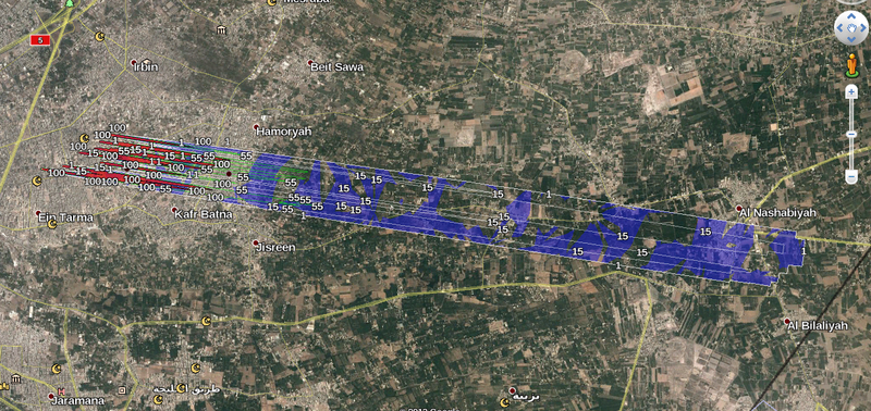
Extent of area affected by Sarin on August 21. '1' contour is the eye effects 1mg.min/m³.
Data is from Atmospheric dispersion modelling using HRW locatons and met data for between 02:00 and 03:00 local time.
Not for commercial use.
File history
Click on a date/time to view the file as it appeared at that time.
| Date/Time | Thumbnail | Dimensions | User | Comment | |
|---|---|---|---|---|---|
| current | 11:35, 8 January 2014 |  | 1,251 × 591 (1.68 MB) | Charles Wood (talk | contribs) | Extent of area affected by Sarin on August 21. '1' contour is the eye effects 1mg.min/m³. Data is from Atmospheric dispersion modelling using HRW locatons and met data for between 02:00 and 03:00 local time. Not for commercial use. |
You cannot overwrite this file.
File usage
The following page uses this file: