File:DRAFT GAS ZAMALKA.png
Jump to navigation
Jump to search


Size of this preview: 800 × 414 pixels. Other resolutions: 320 × 166 pixels | 1,016 × 526 pixels.
Original file (1,016 × 526 pixels, file size: 1.34 MB, MIME type: image/png)
For comment only.
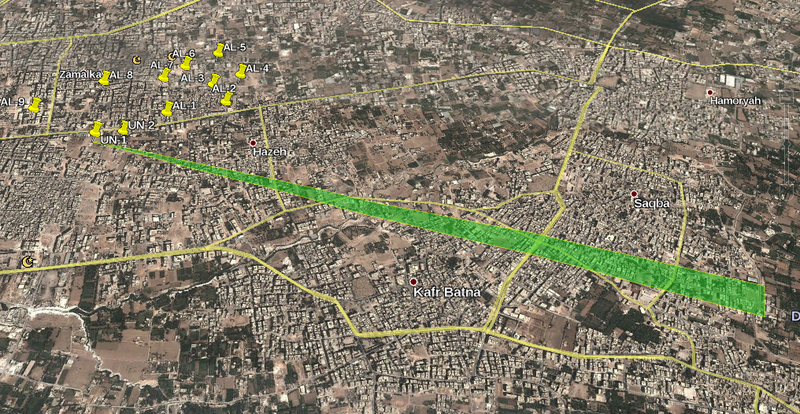
Very preliminary result of computer simulating one of the UN inspected locations using met data from August 21. Green zone is boundaries of Sarin gas cloud for 48kg released.
Lethality is out to around 2000 - 2500 m, with the plume modelled to 3000m
Do not use this image. The entire process needs QA and sanity checks.
File history
Click on a date/time to view the file as it appeared at that time.
| Date/Time | Thumbnail | Dimensions | User | Comment | |
|---|---|---|---|---|---|
| current | 13:13, 5 January 2014 |  | 1,016 × 526 (1.34 MB) | Charles Wood (talk | contribs) | For comment only. Very preliminary result of computer simulating one of the UN inspected locations using met data from August 21. Green zone is boundaries of Sarin gas cloud for 48kg released. Lethality is out to around 2000 - 2500 m, with the plume ... |
You cannot overwrite this file.
File usage
The following page uses this file: