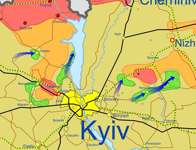
File:Kiev area on 1 April 2022.jpg
Jump to navigation
Jump to search


Size of this preview: 781 × 599 pixels. Other resolutions: 313 × 240 pixels | 1,368 × 1,050 pixels.
Original file (1,368 × 1,050 pixels, file size: 221 KB, MIME type: image/jpeg)
Summary
- Source
- Ukraine War Map @War_Mapper on Twitter, April 1, 2022 15:03 UTC
- Updates:
- 🇺🇦 took back control of Borodyanka and possibly also Vorzel (W of Kyiv)
- 🇺🇦 in the process of securing Bucha, expected to be fully under their control soon
- Related
- Viktoriia 🇺🇸🇺🇦 @ViktoriiaUAH on Twitter, April 1, 2022 19:44 UTC
- If this map is accurate we may see the first encirclement of the war soon. If western most blue dot in the finger is Ivankiv there are no roads between it and the river. Interesting to know what Russian forces may be left inside the pocket.
File history
Click on a date/time to view the file as it appeared at that time.
| Date/Time | Thumbnail | Dimensions | User | Comment | |
|---|---|---|---|---|---|
| current | 18:11, 3 April 2022 |  | 1,368 × 1,050 (221 KB) | Petri Krohn (talk | contribs) | ;Source * Twitter Category:Maps Category:Ukraine |
You cannot overwrite this file.
File usage
The following page uses this file: