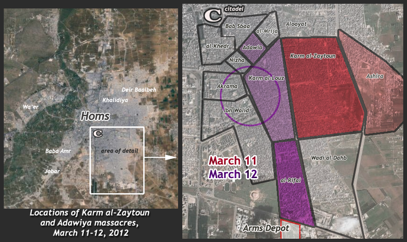
File:Karm al-Zaytoun map 1.png

Original file (864 × 515 pixels, file size: 787 KB, MIME type: image/png)
Notes: Created November 2013 based on neighborhood boundaries from Wikimapia, fatality reports per day recorded in the VDC database. Darker shading = higher death toll, lighter = few to one listed death. The VDC list is incomplete, but also contains entries others don't, like anyone killed from Karm Al-Louz. The purple circle marks the Guardian's roughly-indicated core of Alawite-majority neighborhoods in Homs, including that place. Other opposition sources suggest people from Adewiya were more prevalently included. Se the page this is used on for more details on all that. --Caustic Logic (talk) 14:12, 9 November 2013 (UTC)
File history
Click on a date/time to view the file as it appeared at that time.
| Date/Time | Thumbnail | Dimensions | User | Comment | |
|---|---|---|---|---|---|
| current | 13:45, 5 November 2013 |  | 864 × 515 (787 KB) | Caustic Logic (talk | contribs) |
You cannot overwrite this file.
File usage
The following page uses this file: