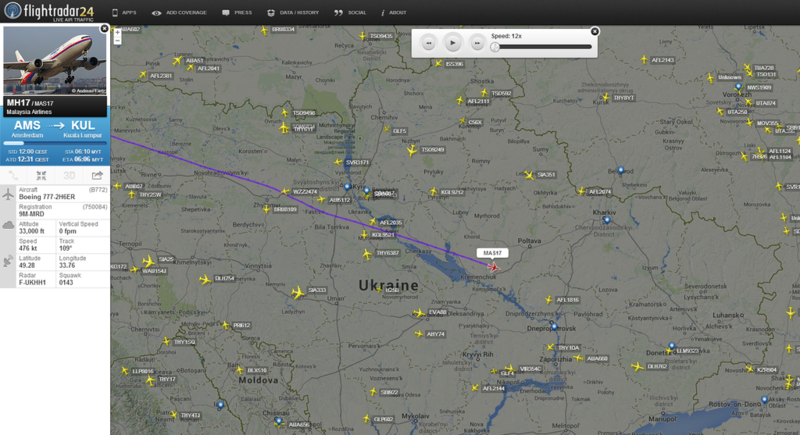
File:Flightradar24 MH17 map Cherkasy.png
Jump to navigation
Jump to search


Size of this preview: 800 × 435 pixels. Other resolutions: 320 × 174 pixels | 1,024 × 557 pixels.
Original file (1,024 × 557 pixels, file size: 1,009 KB, MIME type: image/png)
- Source
- FlightRadar24 on Twitter - 17 July 2014
Radar id F-UKHH1?
Radar id F-UKHH1 is a ADB-S receiver somewhere near the Kharkiv Int'l Airport (Kharkiv, Ukraine) (UKHH / HRK). See map here.
- F-UKHH1 simply indicates Kharkiv is the closest AIRPORT to the receiver location. Generally the airspace it is likely to cover. It doesn't mean thats where it is, it could be 100nm away, but cover with 300nm radius.
File history
Click on a date/time to view the file as it appeared at that time.
| Date/Time | Thumbnail | Dimensions | User | Comment | |
|---|---|---|---|---|---|
| current | 20:21, 29 August 2015 |  | 1,024 × 557 (1,009 KB) | Petri Krohn (talk | contribs) | ;Source * FlightRadar24 on Twitter Note: Radar id F-UKHH1 is a [https://www.youtube.com/watch?v=GQz-CzUqGnw ADB-S] receiver at the [http://forum.flightradar24.com/threads/7777-Malaysian-B777-MH17-crash-poss-shot-down?p=54647&viewfull=1#post54647 Khark... |
You cannot overwrite this file.
File usage
There are no pages that use this file.