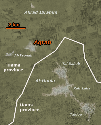
File:Aqrab map 2.png
Jump to navigation
Jump to search
Aqrab_map_2.png (351 × 436 pixels, file size: 193 KB, MIME type: image/png)
Province border source: http://ephotopix.com/syria_province_map.html
With increasingly zoomed-out marked local maps, stretched under this to fit Homs, Hama, and the coastline, adjusted slightly for local features, and only approximate.
File history
Click on a date/time to view the file as it appeared at that time.
| Date/Time | Thumbnail | Dimensions | User | Comment | |
|---|---|---|---|---|---|
| current | 12:01, 20 December 2012 |  | 351 × 436 (193 KB) | Caustic Logic (talk | contribs) | This replaces Aqrab map 2, which did not feature Al-Taonah |
You cannot overwrite this file.
File usage
The following page uses this file:
